
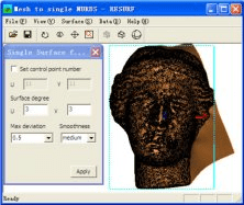
This software can convert an open mesh to a single NURBS surface just one click

It is a program to view on 3D digital elevation maps mixed with data acquired
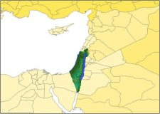
FSGenesis Israel Base Terrain Mesh for FSX tool to visualize Israel terrain.

The project aims to create a first network of Soutth asians and europeans.
